

Lessons from playing Worldle (no, not Wordle)
Lessons from playing Worldle (no, not Wordle)
"I'm in love with (more than) the shape of you"

After Wordle took the world by storm a couple of years ago, it led to a proliferation of spinoff games like Quordle, Octordle, Connections, Framed … you really could spend all day playing games! I limit myself to five of these games each day, first thing in the morning while I’m having my coffee.
My favourite of all the ones I do is WORLDLE (note the extra “l” in there). In Worldle, you’re shown a black outline of a country and you have to identify it in six tries. After each guess it tells you how close you are (using a percentage) and gives an arrow pointing you in the right direction. There are also bonus questions which you can do whether you guess the country or not: guess its neighbour/border countries (also shown in outline), capital, flag, approximate population, and currency.
I really enjoy this game, and it’s taught me a lot about geography. But it’s not easy. I’ve played it 642 times and my win percentage is only 62% (and I’m sure when I started out it was a lot lower than that). It’s hard enough knowing approximately where a country is; it’s a whole other thing to identify it by its shape.
Some countries have very intriguing shapes. Here’s Senegal — almost as far west as you can go on the African continent.
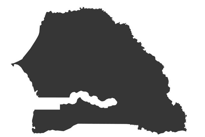
The narrow indentation there on the left almost looks like an animal’s mouth. That’s probably water, right — some kind of bay or fjord opening out into the Atlantic?
Nope. That’s The Gambia, a whole different country.
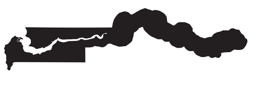
And that narrow indentation on the left is water: the River Gambie, to be exact.
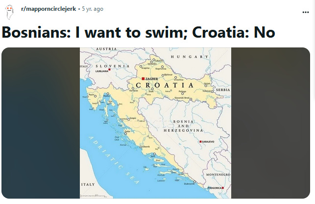
Here’s Bosnia and Herzegovina:
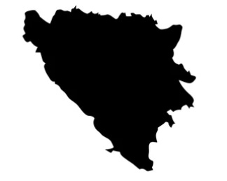
Hmmm, could that be water along the west side there? Not if Croatia has anything to say about it:
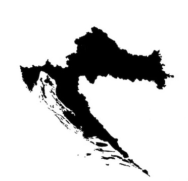
Croatia fits right up against Bosnia and Herzegovina, essentially blocking it off from the Adriatic Sea — and leading to memes like this:
It’s fun and interesting to try to identify a country by its shape, but if you want to really know something about the country you need more than just its outline:
For example, its size — something the game doesn’t tell you. Worldle shows all countries as pretty much the same size, as if Ukraine is equal in size to Russia instead of being only about 1/25th as big.
You need to know its topography. An outline just gives you two dimensions; it doesn’t show you valleys, mountains, plains, or forests. Or cities and other human settlements, for that matter.
It’s also really helpful to know a country’s population. Canada’s and Poland’s populations are almost the same, but Canada is 30 times bigger.
And you need to know its history: does Croatia really have that long piece of land extending down because Croatians wanted to prevent Bosnians from going to the beach? No! (#fakenews)
We can’t conclude much about a person by their shape either. We shouldn’t turn humanity into a game of Peoplele (… or would that just be People?) and assume we know all there is to know about someone just by a flat outline or a few details.
Every one of us has our own unique history, our own mental and emotional landscape. And every one of us is needed. There may be plenty of countries that don’t connect to another nation (New Zealand is the loneliest — its closest neighbour is 1,000 km away!), but there are no people who don’t touch on someone else. Yes, we need personal boundaries — we’re still ourselves, we don’t just blend into others and lose what makes us who we are. But in a world that feels increasingly fractured, where we feel compelled to take sides and protect our fragile borders, we also need to remember that every single person has a neighbour and is a neighbour.
This is lovely, Jeannie! It really resonated with me. That's one of the things that I love about you and your writing: blessedly non-judgmental.
BTW, have you tried playing Blossom? It's the current word game favourite at our house.